57th Annual Report on Research 2012 Under Sponsorship of the ACS Petroleum Research Fund
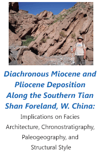
Reports: UNI850776-UNI8: Diachronous Miocene and Pliocene Deposition Along the Southern Tian Shan Foreland, W. China: Implications on Facies Architecture, Chronostratigraphy, Paleogeography, and Structural Style
Richard Heermance, PhD, California State University (Northridge)
OVERVIEW: This project involved detailed stratigraphic and structural investigation of the southern Tian Shan foreland located at 77°E, 40°N in western China. Together, two CSU Northridge students, one Chinese graduate student, and I spent 3 weeks from May 27, 2011-June 18, 2011 collecting field data from deformed foreland basin strata along the southern Tian Shan margin. Overall, we measured ~8000 m of Paleozoic and Cenozoic strata. The upper 3750 m of Miocene, Pliocene, and Quaternary strata were sampled for magnetostratigraphy. 580 oriented samples from 401 stratigraphic levels were collected at ~9m intervals through the section. In addition to stratigraphic description and mapping, structural data was recorded in an effort to document total shortening and shortening rates across the foreland. Upon our return to California State University Northridge, both MS students set about processing, analyzing, and interpreting the paleomagnetic, stratigraphic, and structural data. To date, all samples have been processed, and the students are actively writing up their results. Highlights from this research include 1) documentation of previously un-described eolian strata with ages of 12.4-6.8 Ma, 2) a sharp change to coarse conglomerate of the Xiyu Fm. at 2.1 Ma, 3) the appearance of growth strata (that limits the age of deformation for the underlying structure) at 0.9 Ma, 4) a new cross-section that constrains total shortening of 42 km over the last ~14 Ma, 5) accommodation of the structural deformation via fault bend folding in the north, tri-shear fault propagation folding in the south, and duplex structures underlying the major surface structural lineaments, and 6) a new understanding of the stratigraphic controls on structural style within an individual foreland basin.
STRATIGRAPHY: Over 8 km of Paleozoic and Cenozoic strata were described, although detailed (m-scale) description and measurement was confined to the upper 3750 m Cenozoic section. Paleozoic strata consist of previously described marine and terrestrial units that form the lower half of the thrust sheets. Miocene and Pliocene terrestrial strata unconformably overlie these Paleozoic strata, and can be separated into at least 6 distinct depositional facies: mudflat and marginal lacustrine mudstone, green gypsiferous shale (lacustrine), sandstone and shale interpreted as a meandering fluvial system, reddish sandstone with large cross-beds interpreted as erg deposits, interbedded sandstone, shale, and conglomerate from a low-energy fluvial floodplain environment, and pebble-cobble conglomerate, known regionally as the Xiyu Formation. These strata generally correlate with previously described strata ~100 km to the west within the Kashi Basin, although the Cenozoic strata within the Kepintage region are generally thinner and coarser than those further west, implying that strata thin towards the east, likely on a paleotopographic high.
Magnetostratigraphic results constrains the age of the Miocene-Pleistocene strata between ~14.5-0.9 Ma, consistent with other Kashi Basin strata ~100 km west, despite being one-half as thick as the Kashi section. Sedimentation rates are remarkably consistent at ~350 m/m.y. over this time period. Most interesting from these chronologic results is the appearance of eolian strata between 12.4-6.8 Ma, suggesting that the area was arid and possible marginal to a lacustrine depocenter further west. The appearance of the Xiyu Conglomerate at ~2.1 Ma implies either proximal uplift or climate change at that time, and supports the time-transgressive nature of this formation in the region.
STRUCTURAL GEOLOGY: We combine detailed satellite mapping and structural field analysis with our new stratigraphic data from the western Kepintage thrust belt to provide new information on the structural evolution of the Tian Shan foreland and insight into the controls on structural style and outward growth of the orogen. Detailed mapping of a N-S cross section across the western Kepintage thrust zone indicates three major structural features (E-W lineaments) across the landscape, and these data were used to construct a balanced N-S cross-section through the study area. Lineaments define large antiforms that extend for 100’s of kilometers E-W. However, the northern and southern structural features are actually fault-related folds that have themselves been deformed above underlying duplex structures, while the middle structure appears to be controlled by only one major fault at depth. Overall, structural style changes from fault-bend folds in the northern foreland and fault-propagation folds with a trishear component in the southern foreland. The northernmost duplex juxtaposes Paleozoic strata with Miocene conglomerate, and there is no evidence of Quaternary deformation. In contrast, both of the southern structural lineaments deform Quaternary strata, implying recent (<1.0 Ma) deformation above these structures. Total shortening of ~42 km (~35%) is constrained across the measured section based on line-length analysis, with 15.6 km accommodated across the frontal structural duplex alone.
PRELIMINARY RESULTS AND IMPLICATIONS: Overall, this study provides new stratigraphic and structural data that links the Kashi Basin to the west with the Kalpin Uplift to the east along the Tian Shan Foreland, and documents lateral structural and stratigraphic variability across the foreland. Miocene facies varied from lacustrine and fluvial basin sedimentation to the west that graded into eolian strata on the eastern edge of the basin. The newly recognized eolian strata suggest arid conditions between ~12.4-6.8 Ma, consistent with regional aridification due to uplift of the Tibetan Plateau at that time. Overall, Miocene deposition along the Tian Shan foreland was controlled by the paleotopographic high towards the east, which created the foreland depocenter to the west and created lateral facies changes, including lake-marginal eolian sedimentation, and a condensed stratigraphic section to the east. Lithofacies changes combined with Tertiary sediment thickness likely controlled the apparent change from fault-bend and fault propagation folds in the study area to detachment folding further west. We hypothesize that thick packages of young, weak strata (e.g. Kashi Foreland) favor detachment folding whereas older, more resistant strata (e.g. Kepintage foreland) favor fault bend folding. Thus, the pre-deformation stratigraphic architecture seems to be the dominant control on structural style. This work highlights the complexity of foreland basins for petroleum exploration, and suggests that reservoir potential may be highest along the lake-marginal eolian facies in this area.

