Back to Table of Contents
44868-GB8
Controls on the Development of Mixed Siliciclastic/Carbonate Under-Filled Incised Valleys: Lessons from the Late Pleistocene/Holocene History of Baffin Bay, Texas
Alexander Ray Simms, Oklahoma State University
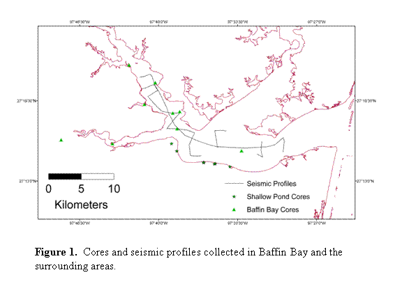
During the past year we have collected a total of 9 cores and 65 km of high-resolution seismic data from Baffin Bay, Texas (Fig. 1). The longest of these cores was 18 m long. In addition, we collected seven additional short cores and 4 elevation profiles from five of the surrounding shallow coastal ponds and lagoons. All but two of these cores have been cut and described to date. The descriptions include grain-size measurements at 20-30 cm intervals, 49 measurements of carbon content, and 9 x-ray diffraction measurements. We have obtained a total of 16 radiocarbon dates from these cores with several additional samples waiting processing. The seismic data and cores within Baffin Bay have been used to construct a structure map of the Pleistocene-Holocene boundary that delineates the base of the Baffin Bay incised valley (Fig. 2). According to seismic profiles, the incised valley reaches depths in excess of 28 m. 14 distinct lithofacies were identified within the valley fill; two of which are dominant – open-bay muds and fluvial/deltaic sands. The valley contains approximately 32% fluvial and deltaic sands at its base overlain by more than 14 m of open-bay muds (Fig. 3). The open-bay muds contain carbonate lamina/beds up to 3 cm in thickness. Isolated reefs and prograding spits are interspersed within the open-bay muds. Three major flooding surfaces marking the backstepping of estuarine environments were identified within the transgressive deposits of Baffin Bay (Fig. 3). The flooding events occurred at approximately 8.0 ka, 5.5 ka, and 4.3 ka. The most distinct flooding event is the 8.0 ka event in which the bay-head delta backstepped over 15 km to a location landward of our data. Our current hypothesis for the cause of this event is a rapid sea-level rise that has been suggested to have occurred around this time period. In addition to the cores within Baffin Bay proper, we utilized field-time in which weather conditions did not allow coring on the water to take a series of vibracores from 5 shallow ponds on the fringes of Baffin Bay (Fig. 1). These ponds are found at elevations ranging from -0.5 mbsl to +2.0 masl. 5 major lithofacies were identified within the 7 cores from these ponds. From these cores and aerial photos were developed a model for their evolution (Fig. 4). In addition, using a combination of carbonate and gypsum as a proxy for marine influence, we were able to test a proposed mid-Holocene highstand within the region. Based on these cores, we suggest that sea-level did not exceed -1.2 m until after 4.8 ka. This finding is in conflict with some reports of higher-than-present sea levels during the mid-Holocene along the US Gulf Coast. An additional finding of this study is the preservation of algal mats within cores from Baffin Bay. Modern algal mats in the vicinity of Baffin Bay are only found in water depths of less than 1 m. Thus they may provide a reliable indicator of past sea levels. Two algal mats were age dated using radiocarbon techniques. The oldest algal mat was found at a depth of 8.25 mbsl within core BB06-02 and was found to be 5.5 ky old. Even with a liberal correction for compaction and subsidence, this, in addition to the data from the shallow ponds, is hard to reconcile with a mid-Holocene highstand. Funds from the grant proposal were also used to support a graduate student's, Niranjan Aryal, travel to Long Beach, CA and present a portion of his Master's Thesis at the American Association of Petroleum Geologists in April of 2007. In addition, Niranjan also presented a poster with Alex Simms as senior author on the evolution of the shallow ponds bordering Baffin Bay at the same meeting but grant funds were not used to reimburse travel for Alex Simms. SHAPE \* MERGEFORMAT Figure 1. Cores and seismic profiles collected in Baffin Bay and the surrounding areas. |
SHAPE \* MERGEFORMAT Figure 2. Contour map of the Pleistocene/Holocene contact forming the base of the Baffin Bay incised valley. |

SHAPE \* MERGEFORMAT Figure 3. Seismic profile and core illustrating the dominant architecture of the Baffin Bay valley fill. See figure 2 for line location. FS1-FS3 represent flooding surfaces discussed in the text. |

SHAPE \* MERGEFORMAT Figure 4. Evolutionary model for the ponds on the margins of Baffin Bay. Stage 1: blowout from eolian processes. Stage 2: connection to Baffin Bay via gulley erosion. Stage 3: Exchange of waters with Baffin Bay via a small tidal inlet. |

Back to top